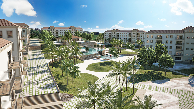
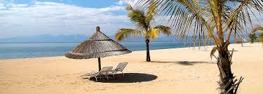
Escape for the Weekend
Explore our collection of weekend
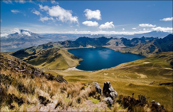
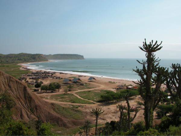
Algeria
Algeria
Algeria
Algeria
Algeria
Algeria
Algeria
Algeria
Algeria
Algeria
Algeria
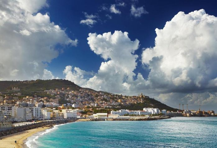
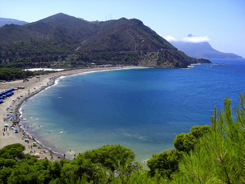
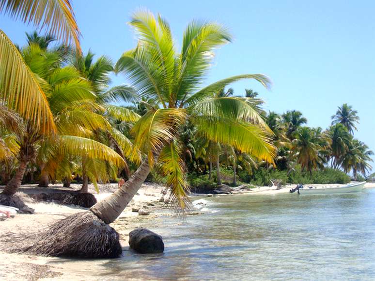
What to see in Algeria? Grand Ergs in the Sahara; the town of Timimoun; stunning Roman ruins of Constantine; the Palais de Raïs in Algiers; Ksours in the Mzab Valley; reefs and corals of Deca Beach.
Algeria, the complete official name is the People's Democratic Republic of Algeria, is a country in North Africa in the western Mediterranean basin. Algeria is the largest African state. It is bordered by Morocco to the west, Mauritania and Mali - to the south-west, Nigeria - to the south-east and Libya and Tunisia - to the east. The total area is 2.4 million kilometers; the population is about 40 million people. The capital is the city of Algiers. The official language is Arabic. Berber and French are also widely spread.
The national currency is the Algerian dinar. You can exchange money at most banks or at official money changers. You may have problems with withdrawal money at ATMs from your credit card, so try to have enough cash. Credit cards are accepted only in big hotels and restaurants.
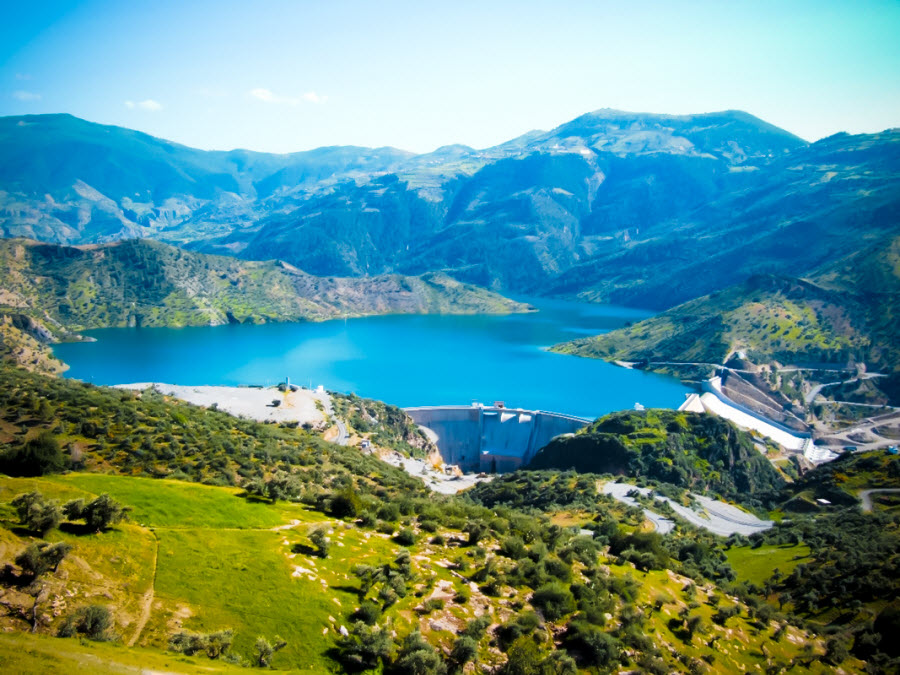
Most of the country lies in the Sahara desert. The coastal area is covered with hills and mountains. Algeria’s coastal areas have a mild Mediterranean climate, hot in the summer and cool and rainy in the winter. Inlands have a dryer and hotter climate.
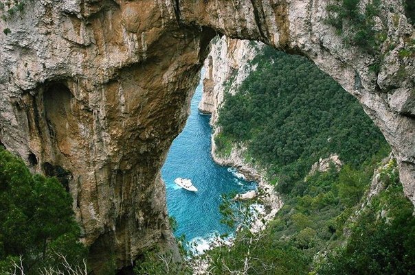
Although a large part of the Algeria is situated in Sahara, the natural wealth of this African country attracts many tourists. Moreover Algeria is extremely interesting for lovers of antiquities. Since there were Romans and Phoenicians, Carthaginians, Byzantines, and Turks, the amazing oriental architecture of buildings, mosques, forts and palaces is combined with Roman, early Christian, Byzantine churches and basilicas.
It’s impossible to feel the atmosphere of Algeria without seeing the Sahara and getting charmed by its austere majestic beauty. You can go trekking by camel through the desert or just visit Grand Ergs in the Sahara. People who spent some time there say that it clarifies thoughts and calms mind. You can have a rest in an oasis, for example in the town of Timimoun, situated near a picturesque red salt lake.
Connoisseurs of ancient architecture should visit Constantine, featuring the country’s most stunning Roman ruins; Tlemcen, a seventeen-century-old city surrounded by vineyards and olive fields, where you can see an amazing Grand Mosque, dating back to 1082; and, of course, the Casbah and the Palais de Raïs in Algiers.
Nature lovers will probably want to see Tassili N’Ajjer National Park with its sandstone mountains, abundant flora and impressive views; the Mzab Valley, where you can see Ksours – fortified towns – built in the 10th century; and Ahaggar National Park, boasting interesting volcanic rock formations and excellent biodiversity.
Houari Boumediene Airport, also called Algiers International Airport (ALG), Algiers
Rabah Bitat Airport (AAE), Annaba
Mohamed Boudiaf International Airport (CZL), Constantine
Oued Irara–Krim Belkacem Airport (HME), Hassi Messaoud
Es-Sénia – Ahmed Ben Bella Airport (ORN), Es Sénia
Zenata – Messali El Hadj Airport (TLM), Tlemcen
Mostépha Ben Boulaid Airport (BLJ), Batna
Soummam – Abane Ramdane Airport (BJA), Béjaïa
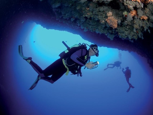
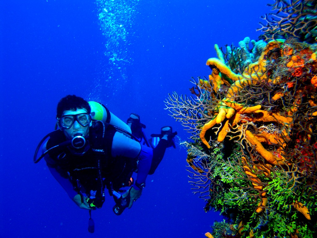
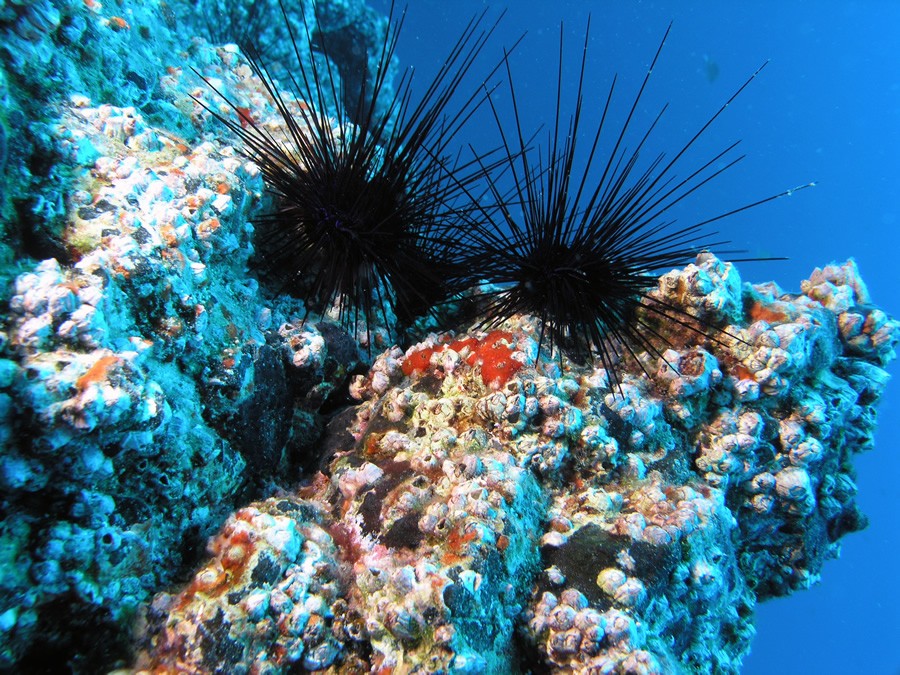
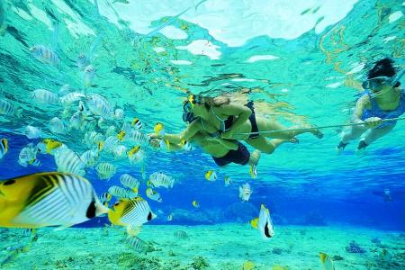
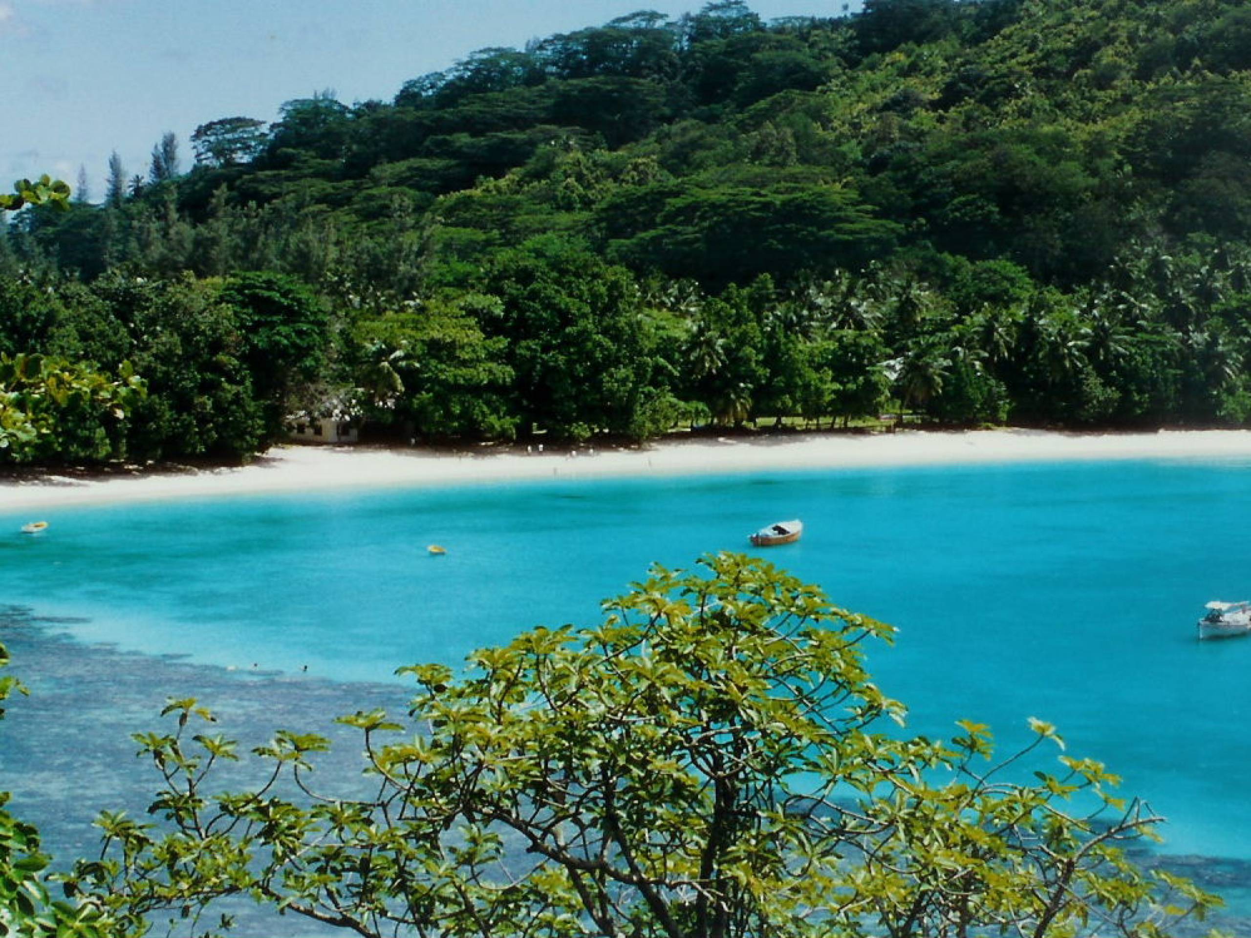
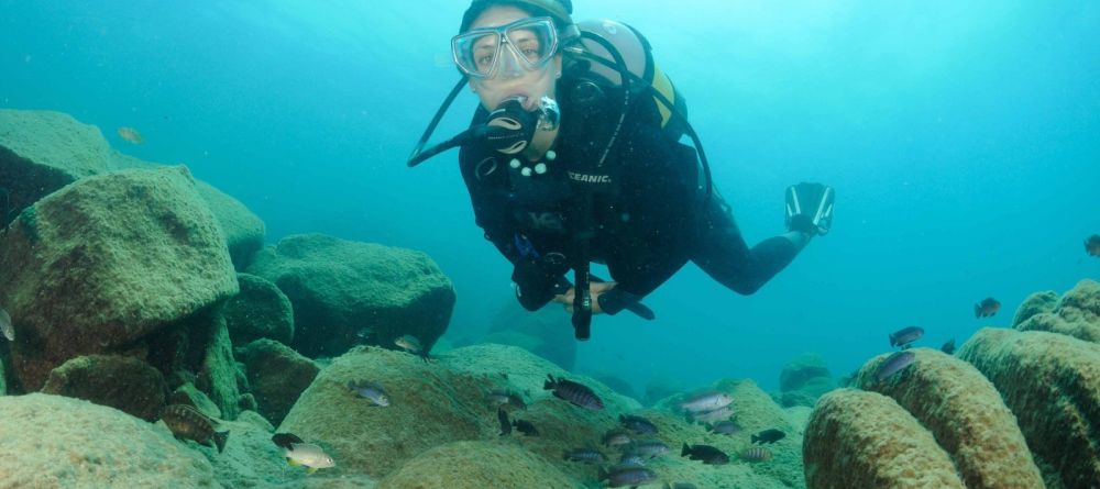
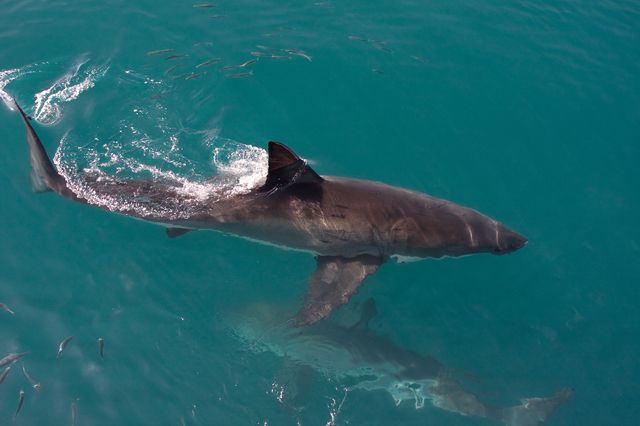
Algeria is not a top diving destination, although the Mediterranean Sea gives some opportunities for diving. The best-known dive site on the Mediterranean coast is Deca Beach where you will find interesting reefs, beautiful red corals and abundant sea life. While diving you can meet hammerhead sharks. The water temperature varies from 14 to 28 degrees Celsius.
Angola
Angola

Angola
Angola
Angola
Angola
Angola
Angola
Angola
Angola
Angola
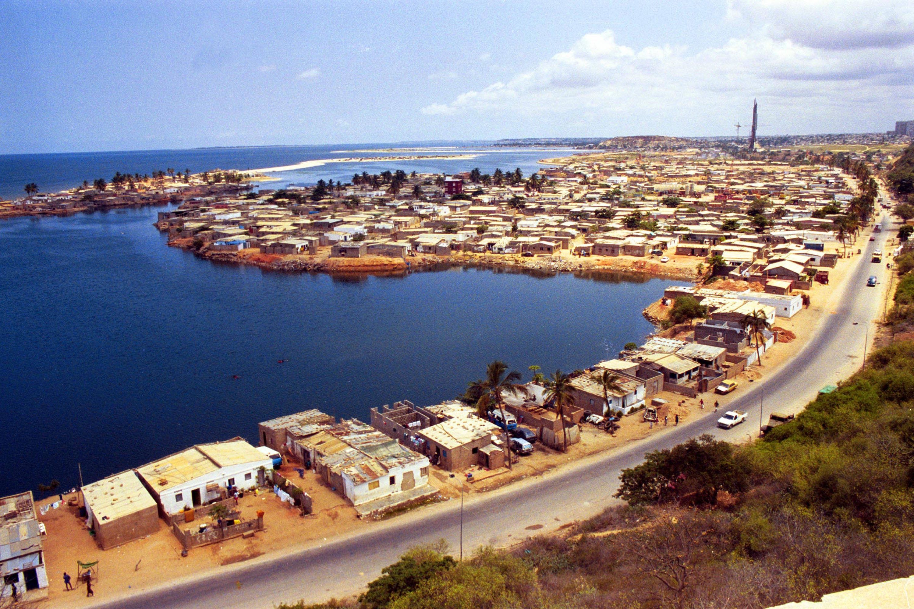
Angola, officially named the Republic of Angola, is a country in Central Africa, bordered by Namibia to the south, the Democratic Republic of the Congo to the north-east and north, Zambia to the east, and washed by the Atlantic Ocean from the west. The total area of Angola comprises 1.2 million square kilometers; the population is 24 million people. The capital of the country is Luanda. The official language is Portuguese.
Angola’s terrain consists of a coastal plain, changed by a belt of hills and mountains, and then a big plateau. The climate is semiarid, with two distinct seasons - the cool one that lasts from June to September; and the rainy one, continuing from October to May.
The national currency is the Angolan kwanza. US dollars are accepted almost everywhere. Money can be exchanged at banks, in many shops or in licensed money changers. Although there are ATMs in Angola, most of them do not accept foreign credit cards.
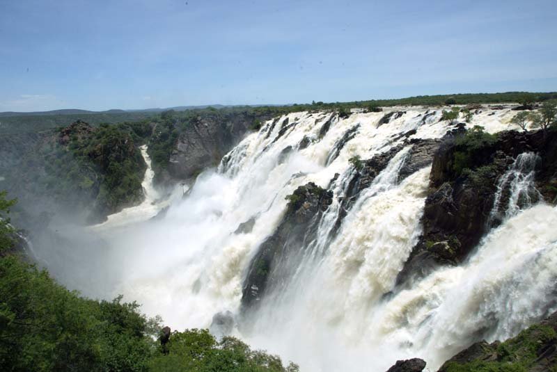
Most tourists, annually visiting Angola are attracted by its amazing nature: the stunning views of the coast, the Namib Desert, located in the southern part of the country, and the savanna.
Moreover, many foreign visitors come to see the traditional life of some tribes living in Angola – some of them have preserved their lifestyle since the Stone Age.
As a result of centuries of colonial status in African states there are not many man-made sights, although you can find some architectural monuments in Luanda.
In Malanje there are the stunning Kalandula Waterfalls, especially impressive in rainy season. In the Kissama National Park you can see lots of different wild animals, including the endemic black palanca antelope. Off the southwest coast of Angola there is Tiger Bay, an isolated island, home to marine turtles and some endangered seabirds. On the coast you can see many forts, built during colonial times, including the well-known Fortress of San Miguel, founded in 1789.
Quatro de Fevereiro International Airport (LAD) the main international airport of Angola, situated near Luanda.
Albano Machado International Airport (NOV), Huambo
Although Angola is not a primary diving destination, its underwater world keeps a lot of interesting. You will find here stunning views, white-sand beaches, clear water and interesting reefs. Many of Angola’s beaches are almost unexplored and uncrowded, which makes them a perfect destination for those who like solitude and discoveries.
Beginning divers will like Lucira Beach with its extensive reefs, good visibility and light currents.
The waters off Bibala Beach are said to have healing properties. It is hard to say whether it is true or not, but diving here will be a good experience.
Benguela Beaches can boast turquoise water, panoramic views and interesting underwater landscape with inlets and coves.
Clear and calm waters of Das Miragens and Azul on the Namibe Peninsula are suitable both for diving and snorkeling.
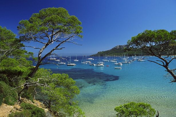
Canary Islands
Canary Islands
Canary Islands
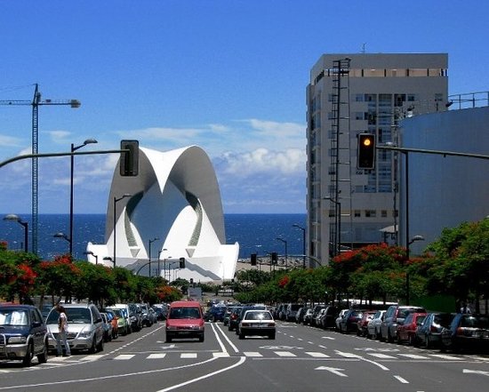
Canary Islands
Canary Islands
Canary Islands
Canary Islands
Canary Islands
Canary Islands
Canary Islands
Canary Islands
Canary Islands
Canary Islands
Canary Islands
Canary Islands
Canary Islands
Canary Islands
Canary Islands
Canary Islands
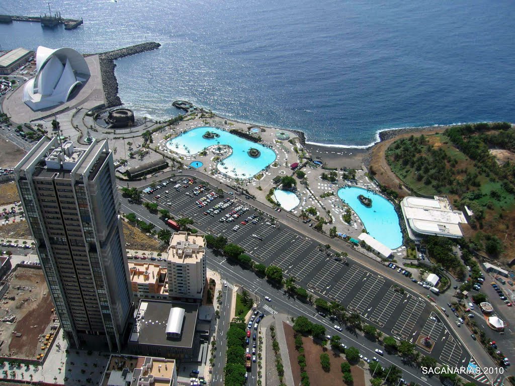
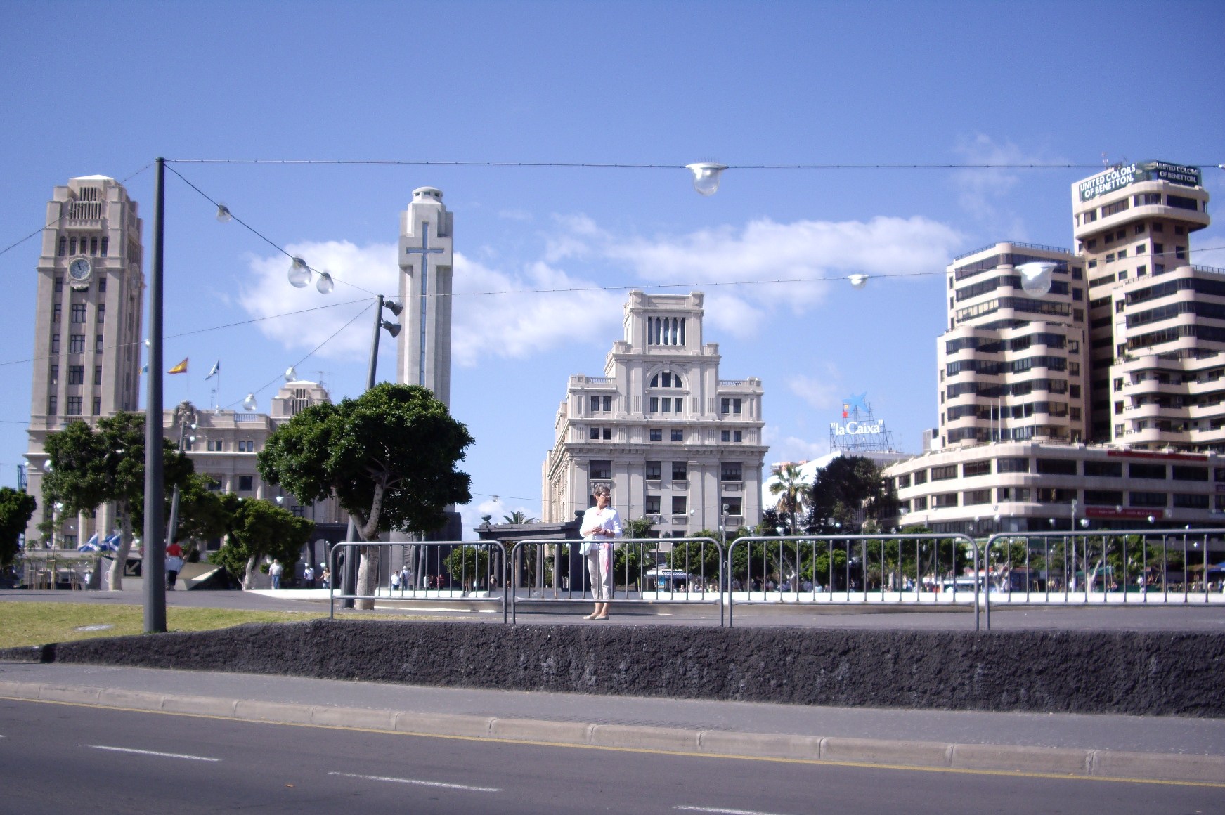
The Canary Islands (/kəˈnɛəri ˈaɪləndz/; Spanish: Islas Canarias [ˈizlas kaˈnaɾjas], locally: [ˈiʱlːaʰ kaˈnaːɾjaʰ]), also known as the Canaries (Spanish: Canarias), are an archipelago and autonomous community of Spain located on the Atlantic Ocean, 100 kilometres (62 miles) west of Morocco. The Canaries are among the outermost regions (OMR) of the European Union proper. It is also one of the eight regions with special consideration of historical nationality recognized as such by the Spanish Government.[3][4]
The Canary Islands (/kəˈnɛəri ˈaɪləndz/; Spanish: Islas Canarias [ˈizlas kaˈnaɾjas], locally: [ˈiʱlːaʰ kaˈnaːɾjaʰ]), also known as the Canaries (Spanish: Canarias), are an archipelago and autonomous community of Spain located on the Atlantic Ocean, 100 kilometres (62 miles) west of Morocco. The Canaries are among the outermost regions (OMR) of the European Union proper. It is also one of the eight regions with special consideration of historical nationality recognized as such by the Spanish Government.[3][4]
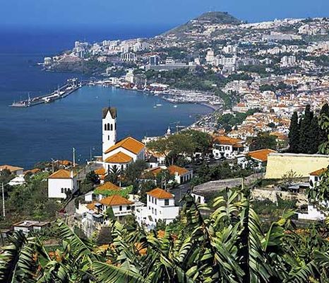
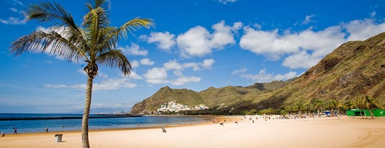
The main islands are (from largest to smallest) Tenerife, Fuerteventura, Gran Canaria, Lanzarote, La Palma, La Gomera and El Hierro. The archipelago also includes a number of islands and islets: La Graciosa, Alegranza, Isla de Lobos, Montaña Clara, Roque del Oeste and Roque del Este. In ancient times, the island chain was often referred to as "the Fortunate Isles".[5] The Canary Islands is the most southerly region of Spain and the largest and most populated archipelago of the Macaronesia region.[6]
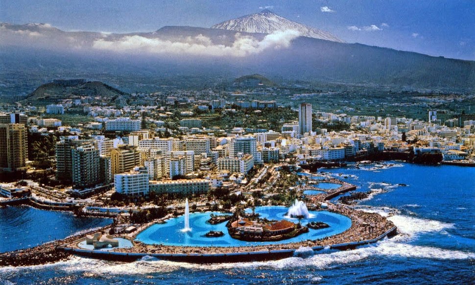
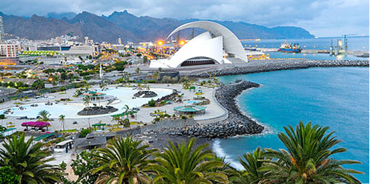
The archipelago's beaches, climate and important natural attractions, especially Maspalomas in Gran Canaria and Teide National Park and Mount Teide (a World Heritage Site) in Tenerife (the third tallest volcano in the world measured from its base on the ocean floor), make it a major tourist destination with over 12 million visitors per year, especially Gran Canaria, Tenerife, Fuerteventura and Lanzarote.[7][8] The islands have a subtropical climate, with long hot summers and moderately warm winters.[9] The precipitation levels and the level of maritime moderation varies depending on location and elevation. Green areas as well as desert exist on the archipelago. Due to their location above the temperature inversion layer, the high mountains of these islands are ideal for astronomical observation. For this reason, two professional observatories, Teide Observatory on the island of Tenerife and Roque de los Muchachos Observatory on the island of La Palma, have been built on the islands.
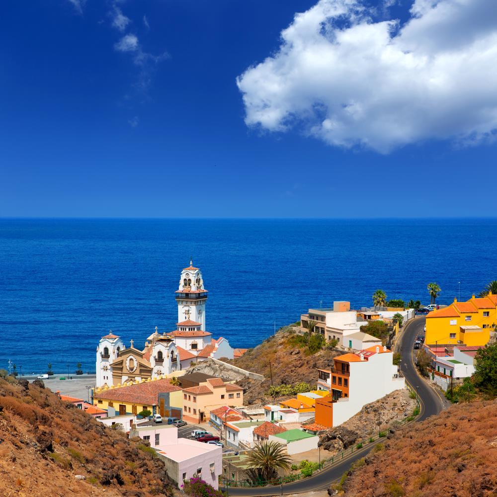
The capital of the Autonomous Community is shared by the cities of Santa Cruz de Tenerife and Las Palmas de Gran Canaria,[10][11] which in turn are the capitals of the provinces of Santa Cruz de Tenerife and Province of Las Palmas. Las Palmas de Gran Canaria has been the largest city in the Canaries since 1768, except for a brief period in the 1910s.[12] Between the 1833 territorial division of Spain and 1927 Santa Cruz de Tenerife was the sole capital of the Canary Islands. In 1927 a decree ordered that the capital of the Canary Islands be shared, as it remains at present.[13][14] The third largest city of the Canary Islands is San Cristóbal de La Laguna (a World Heritage Site) on Tenerife.[15][16][17] This city is also home to the Consejo Consultivo de Canarias, which is the supreme consultative body of the Canary Islands.[18]
During the time of the Spanish Empire, the Canaries were the main stopover for Spanish galleons on their way to the Americas, which came south to catch the prevailing northeasterly trade winds.
The Canary Islands have eight airports altogether, two of the main ports of Spain, and an extensive network of autopistas (highways) and other roads. For a road map see multimap.[73]
There are large ferry boats that link islands as well as fast ferries linking most of the islands. Both types can transport large numbers of passengers and cargo (including vehicles). Fast ferries are made of aluminium and powered by modern and efficient diesel engines, while conventional ferries have a steel hull and are powered by heavy oil. Fast ferries travel relatively quickly (in excess of 30 knots) and are a faster method of transportation than the conventional ferry (some 20 knots). A typical ferry ride between La Palma and Tenerife may take up to eight hours or more while a fast ferry takes about 2 and a half hours and between Tenerife and Gran Canaria can be about one hour.
The largest airport is the Gran Canaria Airport. Tenerife has two airports, Tenerife North Airport and Tenerife South Airport.[74] The island of Tenerife gathers the highest passenger movement of all the Canary Islands through its two airports.[75] The two main islands (Tenerife and Gran Canaria) receive the greatest number of passengers.[76] Tenerife 6,204,499 passengers and Gran Canaria 5,011,176 passengers.[77]
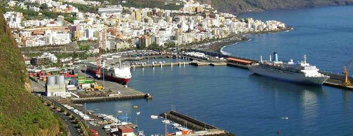
The port of Las Palmas is first in freight traffic in the islands,[78] while the port of Santa Cruz de Tenerife is the first fishing port with approximately 7,500 tons of fish caught, according to the Spanish government publication Statistical Yearbook of State Ports. Similarly, it is the second port in Spain as regards ship traffic, only surpassed by the Port of Algeciras Bay.[79] The port's facilities include a border inspection post (BIP) approved by the European Union, which is responsible for inspecting all types of imports from third countries or exports to countries outside the European Economic Area. The port of Los Cristianos (Tenerife) has the greatest number of passengers recorded in the Canary Islands, followed by the port of Santa Cruz de Tenerife.[80] The Port of Las Palmas is the third port in the islands in passengers and first in number of vehicles transported.[80]
The wreck of American Star (SS America) seen in July 2004 from land side.
The SS America was beached at the Canary islands, in the nineties. However, the ocean liner fell apart after some years and parts of ship washed away.
Rail transport[edit]
The Tenerife Tram opened in 2007 and the only one in the Canary Islands, travelling between the cities of Santa Cruz de Tenerife and San Cristóbal de La Laguna. It is currently planned to have three lines in the Canary Islands (two in Tenerife and one in Gran Canaria). The planned Gran Canaria tram route will be from Las Palmas de Gran Canaria to Maspalomas (south).[81]
Airports[edit]
- Tenerife South Airport – Tenerife
- Tenerife North Airport – Tenerife
- Lanzarote Airport – Lanzarote
- Fuerteventura Airport – Fuerteventura
- Gran Canaria Airport – Gran Canaria
- La Palma Airport – La Palma
- La Gomera Airport – La Gomera
- El Hierro Airport – El Hierro[82]
Ports[edit]
- Port of Puerto del Rosario – Fuerteventura
- Port of Arrecife – Lanzarote
- Port of Santa Cruz de La Palma – La Palma
- Port of San Sebastián de La Gomera – La Gomera
- Port of La Estaca – El Hierro
- Port of Las Palmas – Gran Canaria
- Port of Agaete – Gran Canaria
- Port of Los Cristianos – Tenerife
- Port of Santa Cruz de Tenerife – Tenerife
- Port of Garachico – Tenerife
- Port of Granadilla – Tenerife
Canary Islands
The Fortunate (for Divers) Islands
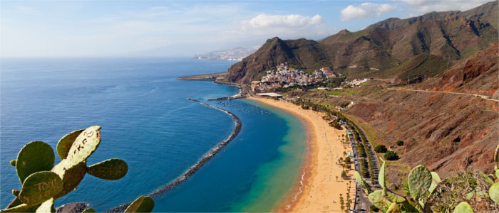
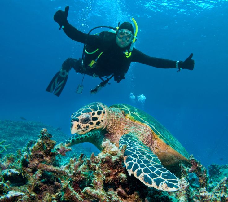
Year-round sun, warm, clear water and dramatic underwater volcanic seascapes draw divers to the Canary Islands. Sometimes called “The Fortunate Islands” due to the subtropical climate and sandy beaches, the islands of this Spanish archipelago lie at the eastern edge of the Atlantic Ocean, off the northwest coast of Africa. The Canaries, as they’re also known, were an important port-of-call for Spanish galleons taking advantage of the trade winds on their way to the Americas.
The seven largest islands – Tenerife, Fuerteventura, Gran Canaria, Lanzarote, La Palma, La Gomera and El Hierro – are premier European tourist destinations and attract more than 12 million visitors a year. Those who come can pick their spot and choose from bustling cities with great nightlife or sleepy little villages where stress just rolls away.
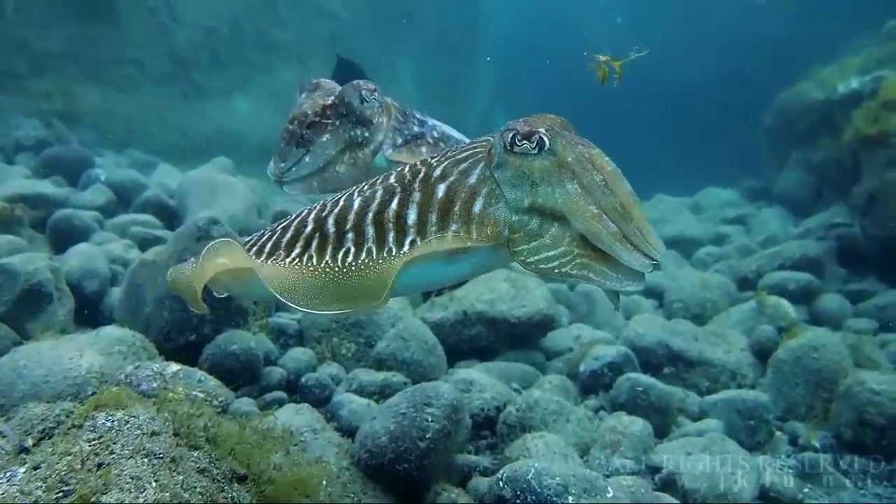
And that’s before you even get to the diving. Visibility of more than 30 metres/100 feet is normal, and water temperatures never drop much below 17-18° C/63-64° F, making it easy to enjoy the unique biodiversity. Divers will encounter both Atlantic and Mediterranean species, and some endemic to the islands themselves.
Great Dives
- La Catedral – This site in Gran Canaria is considered one of the top dives in the region due to the unusual and impressive volcanic formations. Off the coast of La Isleta, just north of Las Palmas, is a morass of lava tubes, caves, arches and crevices. You’ll need a boat and local knowledge to enjoy the best dive on this site.
- The Arona - For shipwreck lovers, Las Palmas in Gran Canaria has a variety of wrecks; some say these are among the best in the world. The Arona is basically in one piece, lying on its side in 40 metres/130 feet of water. It’s well known for the schools of barracuda and other pelagics that patrol her hulk.
- La Restinga - There is a marine reserve on El Hierro where turtles, tuna and dolphins abound; even whale sharks put in an occasional appearance. As recently as 2011, an underwater volcano erupted here, and already marine life is moving back in. El Hierro is the smallest of the Canary Islands and is a bit remote – you have to fly to Tenerife and get a ferry – but the diving makes up for the effort.
- La Burrera - Just off the small island of La Graciosa to the north of Lanzarote lies this site highlighted by a dramatic underwater seascape including pinnacles, columns and large rocky ledges. Marine life is protected here and thrives.
- Cuevo Del Palm Mar – Located ten minutes from Los Cristianos and Las Galletas in Tenerife, is a thrill for advanced and deep divers. Crystal clear water gives incredible visibility to view large rocks, a cave, lobsters, Atlantic barracudas and several species of moray eels. Though gentle and inquisitive, some of these toothy eels are quite ferocious looking.
Want to know more? Visit ScubaEarth® for further information on thousands of dive sites, marine species, destination essentials and more.
Dive Summary
Visibility – Excellent, often exceeds 30 metres/100 feet, depending on local conditions.
Water Temperature – The Canary Islands are bathed by the Gulf Stream, which regulates the water temperature, keeping it between 17-18° C/63-64° F in winter and around 23°C/73°F in summer. Typically, 5mm wet suits in summer and 7mm suits in winter keep divers comfortable.
Weather – Mainly mild winters and warm summers. Year-round warm, sunny weather with average temperatures varying from 17°C in the winter to 24°C in the summer.
Featured Creatures - Fish species include sharks, rays, bream, jacks, grunts, scorpionfish, triggerfish, groupers, gobies and blennies. Invertebrates include sponges, sea fans, jellyfish, anemones, crabs, sea urchins and more.
Recommended Training – Take the PADI Deep Diver and PADI Wreck Diver courses for diving on the deeper wrecks. The AWARE – Fish Identification specialty course is also a good choice to help you identify the many unique species.
Travel Info
Note - Travel to any destination may be adversely affected by conditions including (but not limited) to security, entry and exit requirements, health conditions, local laws and culture, natural disasters and climate. Regardless of your destination, check your local travel advisory board or department for travel advice about that location when planning your trip and again shortly before you leave.
Language - Spanish, with English, French and German spoken in tourist areas.
Currency - Euro. Credit cards are accepted in hotels and tourist-oriented businesses.
Major Airports - Tenerife, Lanzarote, Gran Canaria and La Palma
Electricity and Internet - 220 volts 50hz; European Type C or type E/F two-pin
Topside Attractions - Take a hike up the side of a volcano in a national park, enjoy the buzz of the big busy tourist towns or relax on a beach enjoying the best climate in the world.
Congo (Brazzaville)
Congo (Brazzaville)
Congo (Brazzaville)
Congo (Brazzaville)
Congo (Brazzaville)
Congo (Brazzaville)
Congo (Brazzaville)
Congo (Brazzaville)
Congo (Brazzaville)
Congo (Brazzaville)
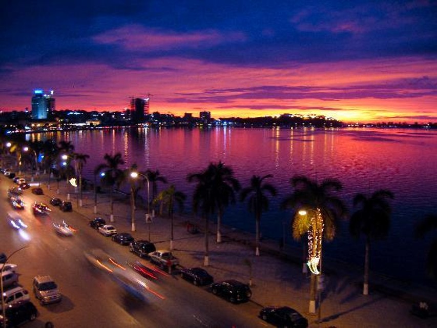
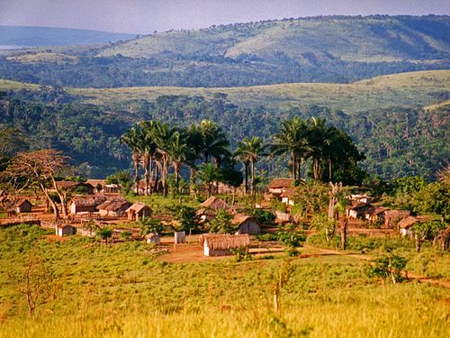
The Republic of the Congo (French: République du Congo), also known as the Congo Republic,[5] West Congo, Congo-Brazzaville or simply Congo, is a country located in Central Africa. It is bordered by five countries: Gabon and the Atlantic Ocean to the west; Cameroon to the northwest; the Central African Republic to the northeast; the Democratic Republic of the Congo to the east and south; and the Angolan exclave of Cabinda to the southwest.
The region was dominated by Bantu-speaking tribes, who built trade links leading into the Congo River basin. Congo-Brazzaville was formerly part of the French colony of Equatorial Africa.[1] Upon independence in 1960, the former colony of French Congo became the Republic of the Congo. The People's Republic of the Congo was a Marxist–Leninist one-party state from 1970 to 1991. Multi-party elections have been held since 1992, although a democratically elected government was ousted in the 1997 Republic of the Congo Civil War and President Denis Sassou Nguesso has ruled for 26 of the past 36 years.
The political stability and development of hydrocarbon production made the Republic of the Congo the fourth largest oil producer in the Gulf of Guinea, providing the country with relative prosperity despite instability in some areas and unequal distribution of oil revenue nationwide.
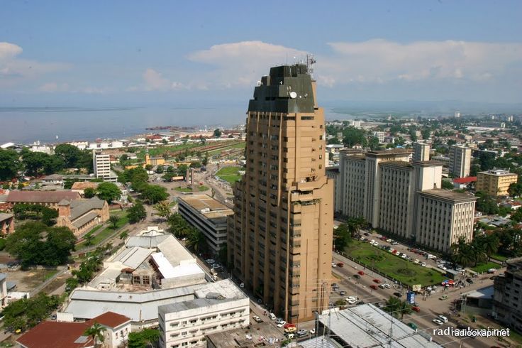
Transport in the Republic of the Congo includes land, air and water transportation. The country's rail system was built by forced laborers during the 1930s and largely remains in operation. There are also over 1000 km of paved roads and two major international airports (Maya-Maya Airport and Pointe Noire Airport) which have flights to destinations in Europe, Africa, and the Middle East. The country also has a large port on the Atlantic Ocean at Pointe-Noire and others along the Congo River at Brazzaville and Impfondo.
When to scuba dive in the Republic of the Congo:Water temperature stays above 20C all year on average.Local standards for gear:The best scuba diving spots in the Republic of the Congo:The best spots to snorkel in the Republic of the Congo:Fun scuba Facts:Country data:Administrative detailsCurrency: Central African franc (XAF)Population: is about 4,000,000 (2009)Time Zone: WAT (GMT+1)Main languages spoke: French, Kongo/Kituba, Lingala ## Diveable overseas territories:Congolese Island diving federations:Local diving laws and regulations (and PADI-equivalent certifications)
Congo (Kinshasa)
Congo (Kinshasa)
Congo (Kinshasa)
Congo (Kinshasa)
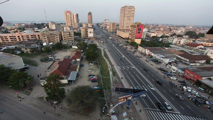
Congo (Kinshasa)
Congo (Kinshasa)
Congo (Kinshasa)
The Democratic Republic of the Congo (/ˈkɒŋɡoʊ/; French pronunciation: [kɔ̃ɡo]; French: République démocratique du Congo), also known as DR Congo, DRC, DROC, East Congo, Congo-Kinshasa, or simply the Congo[6][7] is a country located in Central Africa. The DRC borders the Central African Republic, and South Sudan to the north; Uganda, Rwanda, Burundi and Tanzania to the east; Zambia and Angola to the south; the Republic of the Congo to the west and the Atlantic Ocean to the southwest. It is the second-largest country in Africa by area and eleventh largest in the world. With a population of over 80 million,[1] the Democratic Republic of the Congo is the most populated officially Francophone country, the fourth most-populated nation in Africa and the eighteenth most populated country in the world.
The Democratic Republic of the Congo (/ˈkɒŋɡoʊ/; French pronunciation: [kɔ̃ɡo]; French: République démocratique du Congo), also known as DR Congo, DRC, DROC, East Congo, Congo-Kinshasa, or simply the Congo[6][7] is a country located in Central Africa. The DRC borders the Central African Republic, and South Sudan to the north; Uganda, Rwanda, Burundi and Tanzania to the east; Zambia and Angola to the south; the Republic of the Congo to the west and the Atlantic Ocean to the southwest. It is the second-largest country in Africa by area and eleventh largest in the world. With a population of over 80 million,[1] the Democratic Republic of the Congo is the most populated officially Francophone country, the fourth most-populated nation in Africa and the eighteenth most populated country in the world.
The territory of the DR Congo was first settled about 80,000 years ago. The Bantu migration began in the 7th century. The Kingdom of Kongo ruled from the 14th to 19th centuries. By 1879, Belgian colonization began leading to the establishment of the Congo Free State in 1885. In 1908, Belgium annexed the country which then became the Belgian Congo. During the Congo crisis, Belgium granted its independence in 1960 and in 1965, Mobutu Sese Seko came into power, renaming the country Zaire in 1971. By the early 1990s, Mobutu's regime began to weaken. The Congolese Civil Wars, which began in 1996, brought about the end of Mobutu's 32-year reign[1] and devastated the country. These wars ultimately involved nine African nations, multiple groups of UN peacekeepers and twenty armed groups,[8][9][unreliable source?] resulting in the deaths of 5.4 million people.[10][11][12][13]
The Democratic Republic of Congo is extremely rich in natural resources, but is politically unstable, has a lack of infrastructure, deep rooted corruption, and centuries of both commercial and colonial extraction and exploitation with little holistic development. Besides the capital, Kinshasa, the other major cities, Lubumbashi and Mbuji-Mayi, are both mining communities. DR Congo's largest export is raw minerals, with China accepting over 50% of DRC's exports in 2012. As of 2015, according to the Human Development Index (HDI), DR Congo has a low level of human development, ranking 176 out of 187 countries.[5]
As of June 2016, DR Congo had one major national airline (Congo Airways) that offered flights inside DR Congo. Congo Airways was based at Kinshasa's international airport. All air carriers certified by the DRC have been banned from European Union airports by the European Commission, due to inadequate safety standards.[111]
Several international airlines service Kinshasa's international airport and a few also offer international flights to Lubumbashi International Airport.
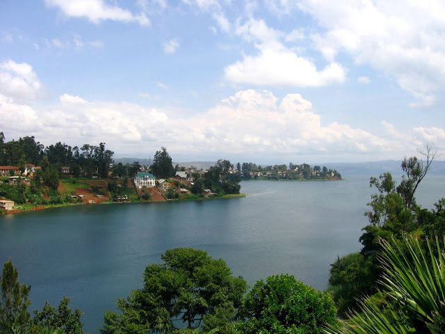
The diving industry is undeveloped across both Congos, and several unique considerations exist for those wishing to do some scuba in the region. Most of the Great Lakes have a build-up of methane in the water from volcanic activity, and Lake Albert is home to a huge variety of hippos - not your friendliest diving partners. The Congo River has very little visibility, even in the Mangroves Park where one might hope to see a manatee. Lac Mai Ndombe is pitch-black.
The best option for diving would be in Lake Tanganyika, from Kalemie. Some small diving operations exist here for the purpose of collecting exotic fish - don’t count on them assisting your own diving excursions in any way.
Egypt
Egypt
Egypt
Egypt
Egypt
Egypt
Egypt
Egypt
Egypt
Egypt
Egypt
Egypt
Egypt
World famous Sharm el-Sheikh and Hurgada resorts; ancient Alexandria; the Sun Temple of Ramses II in Aswan; the Valley of the Kings in Luxor; the White Desert and the Black Desert; the Blue Hole and the Canyon in Dahab; and the Thistlegorm wreck.
Egypt, officially the Arab Republic of Egypt, is a country located in North Africa and the Sinai Peninsula of Asia and is therefore a country of two continents. The total area of Egypt comprises 1 million square kilometers; the population is more than 88 million people.
In the north-east Egypt borders Israel and the Gaza Strip, in the south – Sudan, in the west – Libya. In the north Egypt is washed by the Mediterranean Sea, in the east – by the Red Sea. The seas are connected by the man-made Suez Canal. The capital of the country is Cairo. The official language is Egyptian Arabic.
Most Egypt’s terrain is desert with a few oases. The climate is hot, dry and sunny. The coastal climate is softened by Mediterranean winds.
The national currency is the Egyptian pound. All major credit cards are widely accepted. Most cities and towns have ATMs. You can exchange money at banks (where exchange rates are better), official bureaux de change outlets and most hotels.
What do you associate Egypt with? – Certainly, with pyramids, giant temples, huge statues, ancient fortresses, obelisks and bas-reliefs, hot springs, a unique white desert containing many notable places, as well as fantastic coral reefs and colorful tropical fish.
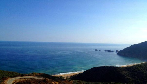
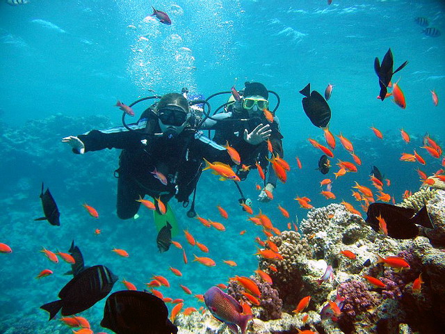
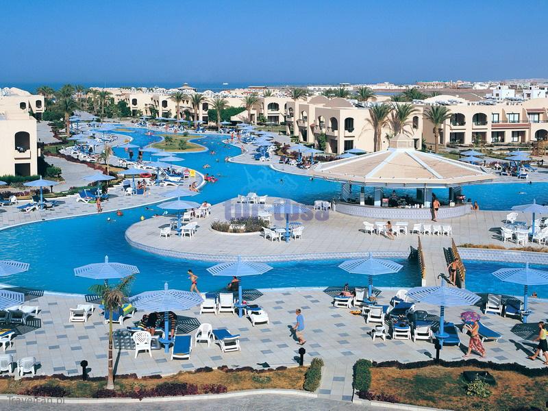
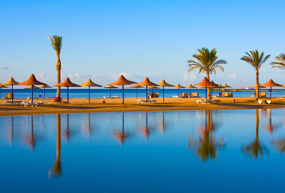
Those who come to Egypt to bask in the sun will be absolutely satisfied with Sharm el-Sheikh and Hurgada with their numerous sandy beaches, lots of comfortable hotels and perfect diving opportunities. Cheaper accommodation can be found in Dahab, which also offers perfect opportunities for windsurfing, rock climbing, scuba diving and desert trekking.
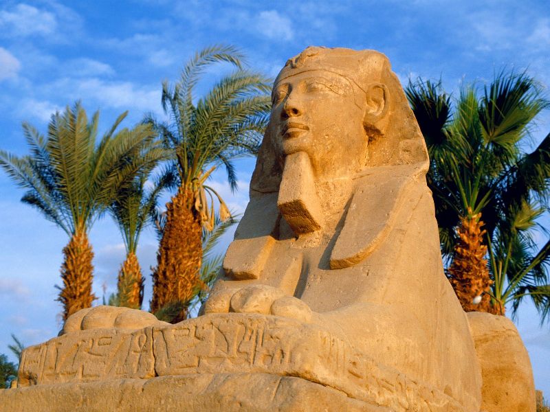
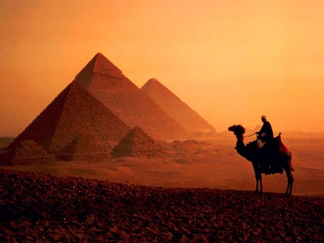
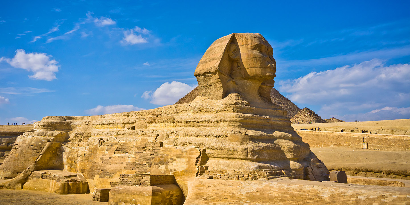
History enthusiasts should visit Alexandria, founded 23 centuries ago by Alexander the Great and still holding many cultural attractions; Siwa Oasis, where you can see ancient fortresses built of mud; Dahshur, a necropolis where the Bent Pyramid and the Red Pyramid, built 4 thousand years ago, can be seen; Aswan, with the Sun Temple of Ramses II and the temples of Philae and Kabasha; Luxor, attracting by the ancient royal tombs of the Valley of the Kings and the ancient temples of Karnak and Luxor; and, of course, the Giza necropolis, with the world famous pyramids and the Sphinx. In Cairo do not miss the chance to visit Al-Azhar Mosque, the Enlightened Mosque and Sultan Qalawun Mosque – perfect examples of Islamic architecture.
Nature lovers will be glad to see the White Desert, whose landscapes resemble an alien planet; the Black Desert, featuring black rocks and volcanic hills; the fantastic Desert Breath and the amazing Lake Qarun.
El Nouzha Airport or Alexandria International Airport (ALY), Alexandria
Aswan International Airport (ASW), Aswan
Cairo International Airport (CAI), the busiest airport of Egypt, located near Cairo.
El Arish International Airport (AAC), El Arish
Hurghada International Airport (HRG), Hurghada
Luxor International Airport (LXR), Luxor
Marsa Alam International Airport (RMF), Marsa Alam
Sharm el-Sheikh International Airport (SSH), Sharm el-Sheikh
St. Catherine International Airport (SKV), Saint Katherine city
Taba International Airport (TCP), Taba
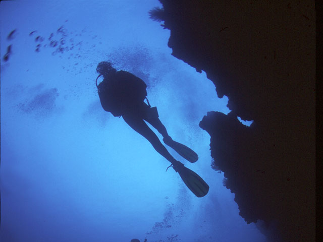
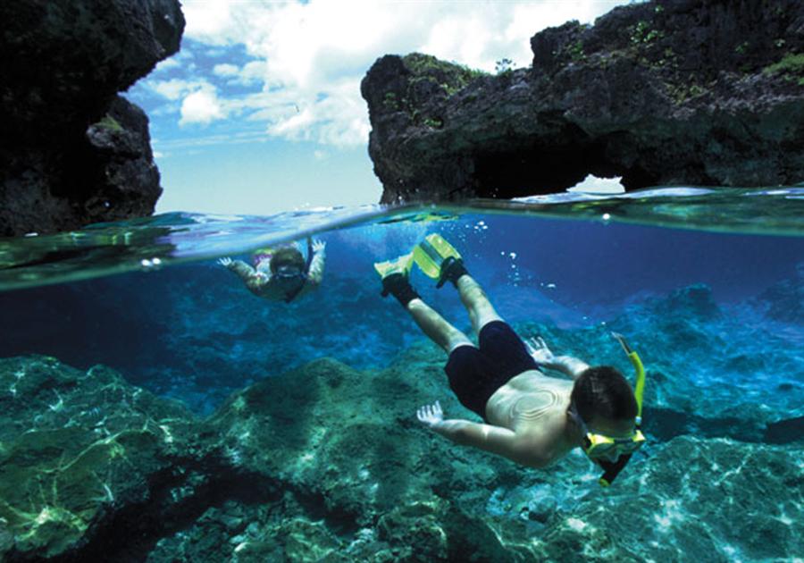
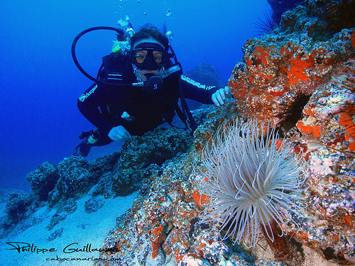
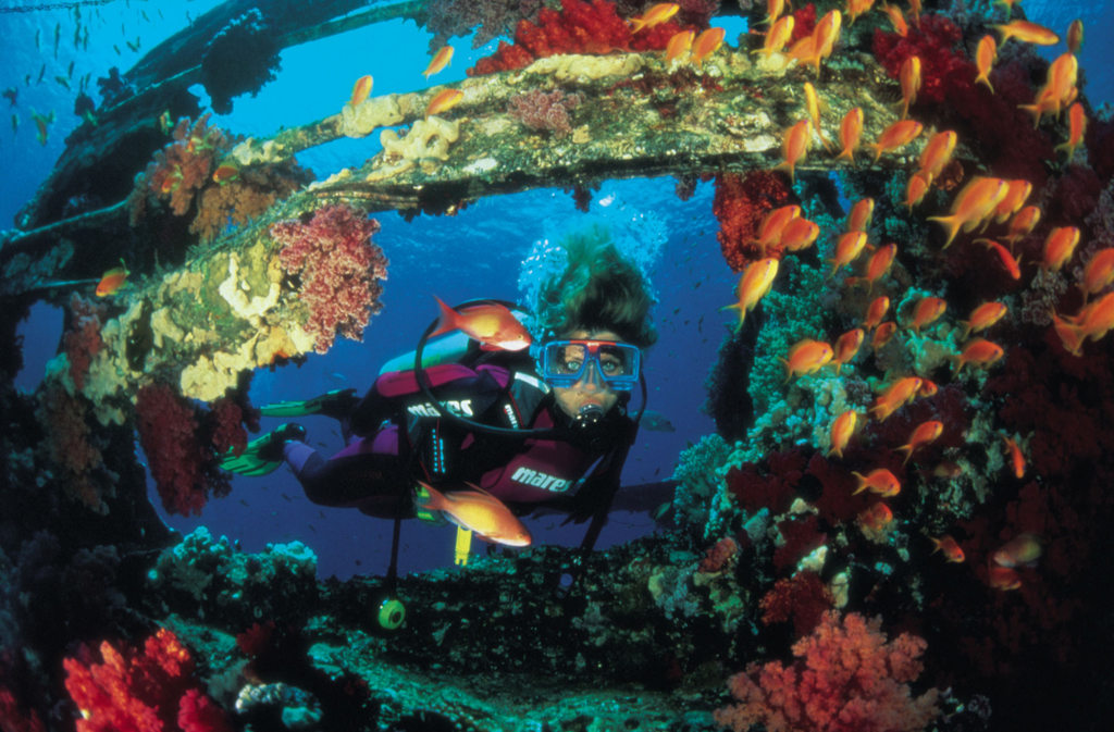
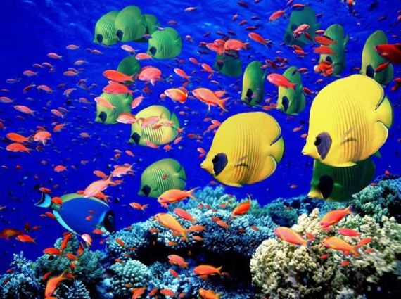
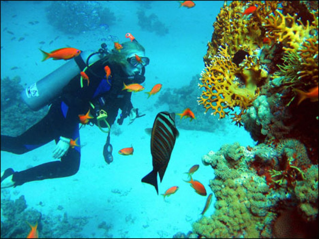
The Red Sea is a real treasury for divers. Where else will you find so many gorgeous reefs, perfect visibility, millions of fish, towers, sheltered reefs, coral gardens, pinnacles, walls and wrecks?
Off Farun Island you can go wall diving and enjoy colorful corals, teeming with breams, batfish, moray eels and frogfish – and endemic marine species.
The marine reserve of Giftun Island can boast precipitous drop offs, amazing coral reefs and abundant marine fauna, which includes barracudas, tunas and other big pelagic species.
In Ras Mohamed National Park you will also find fabulous coral reefs, inhabited by plenty of various fish. The strong currents give opportunity of drift diving.
One of the most popular dive sites in Egypt is Seven Pillars, situated not far from Safaga. These 14-meter high coral formations are beloved by Napoleon wrasse, lionfish and puffer fish.
In the Shadwan Channel there are 5 cargo shipwrecks, the oldest of which – the Carnatic sunk in 1869 after hitting a reef. The wrecks are covered with soft corals and nudibranches and inhabited by various critters, including octopuses and giant moray eels.
In Aqaba you will find about 25 dive sites, offering stunning coral gardens, pinnacles and the Cedar Pride, a well-known wreck, covered with a picturesque carpet of soft corals and sponges.
In the waters of the Brothers Islands you will discover an amazing world of steep walls, impressive corals and abundant sea fauna, including gray reef sharks, white-tip reef sharks and hammerheads.
In Dahab you have an opportunity to explore two world famous dive sites – the Blue Hole and the Canyon.
40 kilometers from Sharm El Sheikh there is probably the most popular wreck in Egypt – the Thistlegorm, a British army freighter sunk in 1941 with all her cargo, including tanks, armoured vehicles and aircraft.
Madagascar
Madagascar
Madagascar
Madagascar
Madagascar
Madagascar

Madagascar
Madagascar
Madagascar
Madagascar
Madagascar
Madagascar
Madagascar
Madagascar
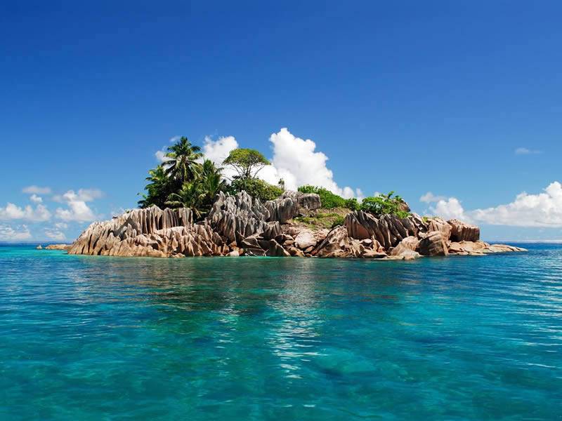
Lemurs of the Masoala National Park; the Avenue of the Baobabs; pinnacles of the Tsingy de Bemaraha Reserve; boat wrecks and coral reefs of Nosy Be and Sainte Marie; rich marine life and wrecks of Sakatia.
Madagascar, or the Republic of Madagascar, is an island nation in the Indian Ocean, located on the fourth largest island in the world and several smaller islands off the coast of Africa. The total area of the country is 587 thousand square kilometers; the population is about 24 million people. The capital is Antananarivo. The official languages are Malagasy and French.
The national currency is the Malagasy ariary. Major credit cards are widely accepted, though outside big cities it is highly recommended to have enough cash. You can exchange money at banks or big hotels, or you can withdraw the local currency in ATMs, which can be found in most cities.
Madagascar’s terrain consists of a narrow coastal plain, a high plateau and mountains in the center. The highest mountain is Maromokotro (2.9 kilometers). The climate of Madagascar is tropical in the coastal regions, arid in the south and temperate inland.
It is said that Madagascar became the first island on the Earth after separating from Gondwana about 6 million years ago. It became inhabited by people only 2 thousand years ago. Madagascar is often called the eighth continent for its great biodiversity – thousands of animal and plant species can be found here.
Madagascar is famous for its lemurs, which can be seen and admired in the Ranomafana National Park, a very picturesque area with plentiful streams running among hills, covered with lush forests; the Masoala National Park, home to ten species of lemur and lots of birds and reptiles; and in Andasibe-Mantadia National Park, featuring the largest lemur of the island.
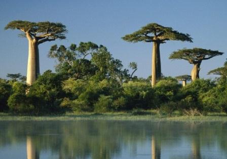
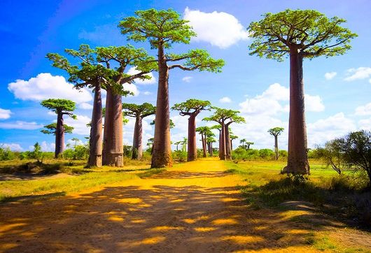
Nature lovers will be glad to see The Avenue of the Baobabs, some of which are 8 centuries old; the Tsingy de Bemaraha Reserve, where you can see a fantastic landscape formed by limestone pinnacles; and the Isalo National Park, including grassland, sandstone formations and precipitous canyons.
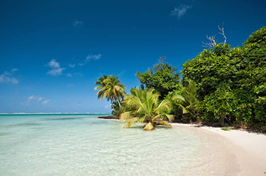
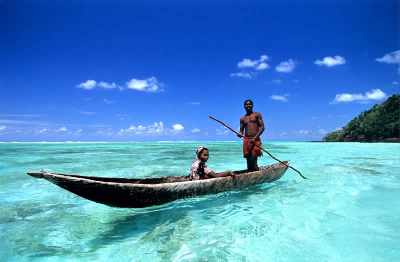
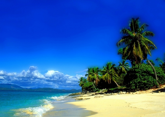
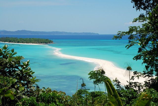
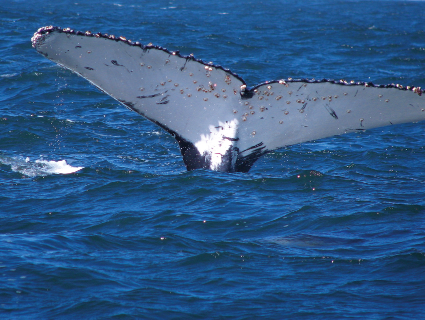
Those who come to Madagascar to busk in the sun listening to tranquiling ocean voice, will praise the beaches of the Ile Sainte Marie, where you can see the wrecks of pirate ships and watch migrating humpback whales from the shore; and the coast of Ifaty, whose crystal clear waters are ideal for swimming and snorkeling.
Connoisseurs of history will like Ambohimanga, the former capital of Madagascar, where you can see the former royal residence with rosewood walls and some artifacts of King Andrianampoinimerina.
Airports
Ivato International Airport (TNR), the main international airport of Madagascar located 16 kilometers from Antananarivo.
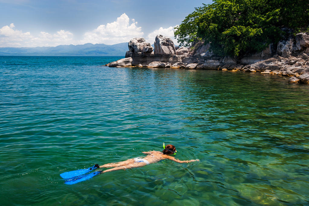
Diving in Madagascar
Diving in Madagascar has been attracting an increasing number of divers. Lots of pristine coral reefs, underwater visibility and an exceptional richness and diversity of marine fauna make diving in these waters truly memorable. The coast of the western part of the country features continuous and steep cliffs and great variety of species. The east coast of the island is also very suitable for diving.
Most dive sites are located around Nosy Be Island in the upper north-west, Ile Sainte Marie in the east and Tulear Island in the south-west.
Diving near Nosy Be you will see some fishing boat wrecks and plenty of coral reefs, especially in the marine park of Nosy Tanikely. The underwater fauna includes sea turtles, hammerhead sharks, crocodile fish, whale sharks, groupers and manta rays. Moreover, from September to November migrating humpback whales can be seen here.
The waters of Sainte Marie feature interesting wrecks and fancy coral formations.
Off Sakatia you will find various dive sites from 6 to 50 meters deep, with walls, coral reefs, drops, pinnacles and stunning gorgonians, where it is possible to meet dolphins, whale sharks, whales and manta rays. Beside that here you will find 4 middle-sized wrecks lying at a depth of 26-29 meters.
Malawi
Malawi
Malawi
Malawi
Malawi
Malawi
Malawi
Malawi
Malawi
Malawi
Malawi
Malawi
Malawi
Malawi
Malawi
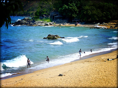
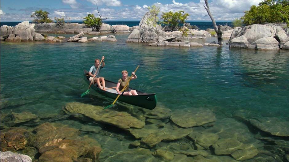
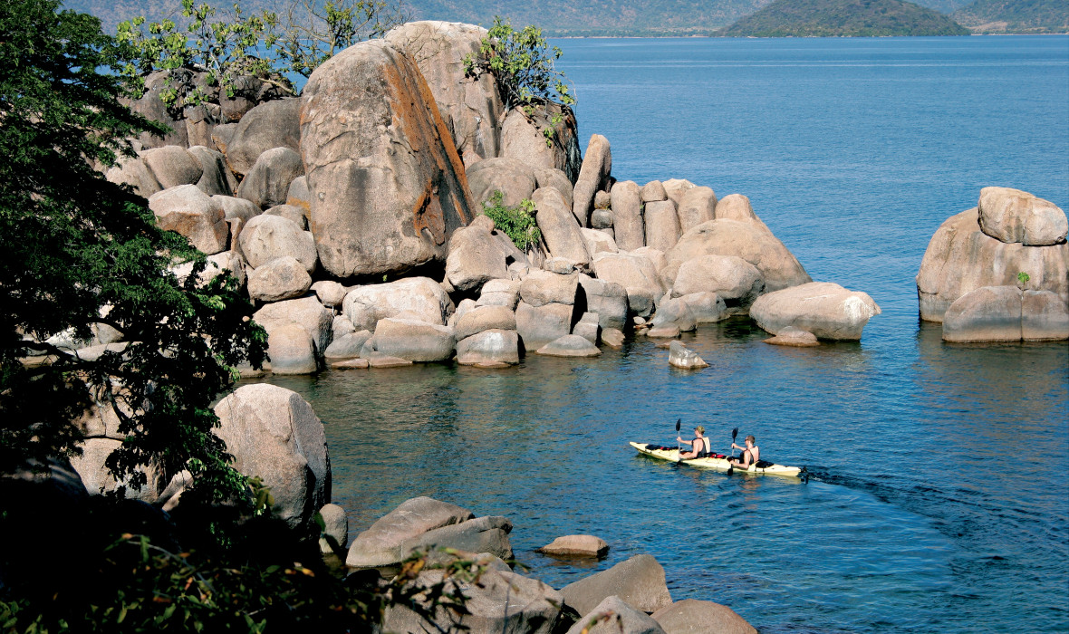
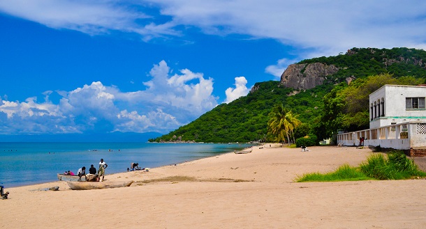
Stunning wildlife of the Lake Malawi National Park; tea plantations; waterfalls of Zomba Plateau; the Old Town of Lilongwe; tropical underwater fauna of Lake Malawi; and caves and tunnels of Cape Maclear.
Malawi, officially the Republic of Malawi is a state in East Africa. To the south and south-east it is bordered by Mozambique, to the west - by Zambia, to the north - by Tanzania. The total area of the country comprises 118.5 thousand square kilometers; the population is 16.5 million people. The capital of Malawi is Lilongwe. The official languages are Nyanja and English.
Much of Malawi’s terrain is a large plateau, in the north there are rugged mountains, while the southern part of the country is a part of the Great African Rift Valley. The climate is moderate in the highlands, and hot in Shire River Valley. The rainy season continues from November to April, and the dry season lasts from May to October.
The national currency is the Malawian kwacha. It is recommended to exchange money at registered bureaux or banks in order to avoid fake banknotes. Credit cards are generally accepted.
Malawi is one of the most exotic countries in Africa. Lush vegetation, crystal-clear lakes, fertile valleys, and tower-shaped mountains make Malawi very attractive for tourists. In Malawi there are eleven national parks and reserves, containing great variety of flora and fauna. The most popular is Liwonde National Park, located on the banks of Shire River, where you can meet hippos, elephants and lots of birds. Another popular destination for nature lovers is The Lake Malawi National Park, inhabited by baboons, leopards, vervet monkeys, spotted hyenas, black eagles, African pythons, plentiful lizards and crocodiles.
In Southern Malawi you can visit stunning tea plantations. On a clear day the majestic Mount Mulanje can be seen rising up out of the emerald tea fields.
On Nyika Plateau you can enjoy cooler weather, amazing sceneries and graceful antelopes. Zomba Plateau boasts dense pine forests, waterfalls and dams full of trout.
In Lilongwe, the capital city of Malawi, it will be interesting to walk along the Old Town, do some shopping in its colorful markets, and see the modern city architecture, within the frame of lush gardens.
Those who like climbing and hiking should visit Mulanje Mountain, a very picturesque mountain with lots of hiking routs, some of which are suitable for families.
Airports
Lilongwe International Airport (LLW), also called Kamuzu International Airport, situated near Lilongwe.
Chileka International Airport (BLZ) serves Blantyre, Malawi’s second largest city.
Diving in Malawi
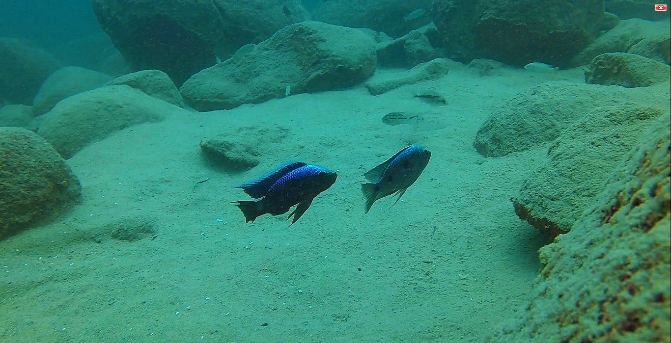
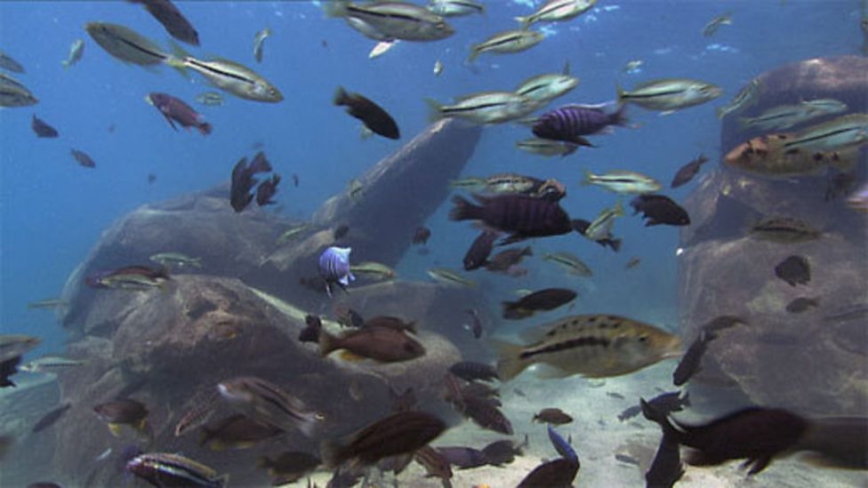
As Malawi is a landlocked country, diving here is possible only in the large freshwater Lake Malawi inhabited by around a thousand species of tropical fish - 350 of which are endemic (Most of them belong to the cichlidae family).
About 30 per cent of the lake’s bottom is rocky. It has few plants and little organic material, which provides excellent visibility.
Lake Malawi covers one third of Malawi’s terrain. The maximal depth of the lake is about 706 meters.
One of the most popular dive sites is Cape Maclear, a fresh-water marine reserve, where you will find interesting caves, rocks, tunnels and boulders.
Those who are fond of deep diving will like Zimbawe Rock with its plentiful channels, stunning swim-throughs and rich marine life.
Mozambique
Mozambique
Dugongs in the national marine park of the Bazaruto Archipelago; coral reefs and lush mangrove forests in the Quirimbas Archipelago; mantas cleaning in Manta Reef.
Mozambique, or the Republic of Mozambique, is a state in East Africa, a former Portuguese colony and an independent state since 1975. Mozambique is washed by the Indian Ocean on the east and borders Tanzania to the north, Malawi and Zambia – to the northwest, Zimbabwe - to the west and Swaziland and South Africa - to the south. The total area of Mozambique comprises almost 802 thousand square kilometers; the population is 24 million people. The capital of the country is Maputo. The official language is Portuguese.
The terrain consists of a narrow coastline, inland hills and low plateaus, which then change into rugged highlands. The climate is tropical with two distinct seasons: the wet season lasts from October to March and the dry one continues from April to September.
The national currency is the Mozambican metical. You can exchange money at banks or bureaux de change. ATMs, where you can withdraw the local currency from your card, can be found throughout the country. Credit cards are widely accepted in Maputo, while outside the capital you can have problems with them.
Mozambique is one of the oldest countries in the world where peopleappeared about two million years ago. It is a country of amazing nature (both terrestrial and marine), ancient towns and gorgeous sand beaches.
The capital of the country, the picturesque Maputo, still preserving lots of examples of colonial architecture, is a good place for shopping and active nightlife. Being in the capital, do not miss the chance to visit Maputo Elephant Park, inhabited by leopards, jackals, antelope, flamingoes, crocodiles and hippos.
Other national parks, which attract to Mozambique lots of nature enthusiasts, are Quirimbas National Park, where you can enjoy beautiful marine life while snorkeling and diving; Marromeu National Park, home to buffalos and various birds; Niassa Reserve, boasting breathtaking sceneries and Gorongosa National Park, often called the best of the country’s reserves. You can go on safari or go hiking to plunge into the atmosphere of amazing wild nature.
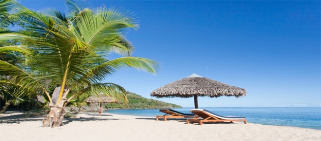
Mozambique is an ideal destination for those who prefer lazy basking in the sun. There are plenty of perfect beaches here; the most popular of them are Ponta do Ouro, Chonguene, Malugane, Vilankulo, Inhambane in Tofo and Xai-Xai.
Airports
Maputo International Airport (MPM), also called Lourenço Marques Airport or Mavalane International Airport, is the main international airport of the country situated 3 kilometers from Maputo.
Diving in Mozambique
2,000-kilometer coastline, islands surrounded by pristine reefs and comfortably warm clear water all year round offer lots of opportunities for good diving. The plankton rich waters of Mozambique attract whale sharks and manta rays; moreover here you have a chance to see humpback whales migrating through the Mozambique Channel.
Near the Bazaruto Archipelago, consisting of five tropical islands, there is a national marine park where you can find about 2 thousand fish species and a very rare mammal, sea cow or Dugong. In the lakes and pools of the islands you can also see Nile crocodiles and marine turtles.
Off the Quirimbas Archipelago there is Primeiras and Segundas Marine Protected Area, the largest one in Africa, where you can admire bright coral reefs and lush mangrove forests.
In the Maputo Protection Area you can see marine turtles and amazing reef ecosystems.
Manta Reef situated near Tofo is famous for interesting show of cleaning giant mantas by the local tropical fish: goldies, butterflyfish and cleaner wrasses.
In Kingfisher Reef, near Inhambane you will find great diversity of underwater fauna and flora, including plenty of tropical fish and many giant manta rays visiting cleaning stations.
Off Pemba there is the Gap, a picturesque wall dive, plunging up to 120 meters and beloved by big gorgonian fans and large fish.
In the waters of Ponta do Ouro you will find Doodles, a colorful long reef with small drop-offs, teeming with shrimp, turtles, snappers and boxfish; and Pinnacles, a deep reef where you can meet hammerhead sharks.
Namibia
Namibia
Namibia
Namibia

Namibia
Namibia
Namibia
Namibia
Namibia

Namibia
Namibia
Namibia
Namibia
Namibia
Elephants and rhinos of Etosha National Park; seals of Cape Cross; the Fish River Canyon; the Waterberg Plateau Park; the Himba in Kaokoland; the Skeleton Coast; the WWI artifacts of Lake Otjikoto; and underwater caves of Lake Guinas.
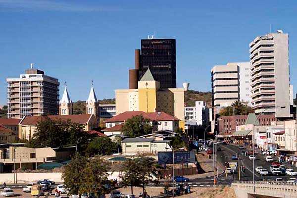
Namibia, officially the Republic of Namibia, is a country in southern Africa, which has borders with Angola and Zambia to the north, with Botswana to the east, and with South Africa to the south-east and south. Namibia is washed by the Atlantic Ocean. The total area of the country is 824 thousand square kilometers; the population is about 2.4 million people. The capital is Windhoek. The official languages are English and Afrikaans.
The national currency is the Namibian dollar. Money can be exchange at most banks. Major credit cards are generally accepted. ATMs can be found nearly in all cities and towns.
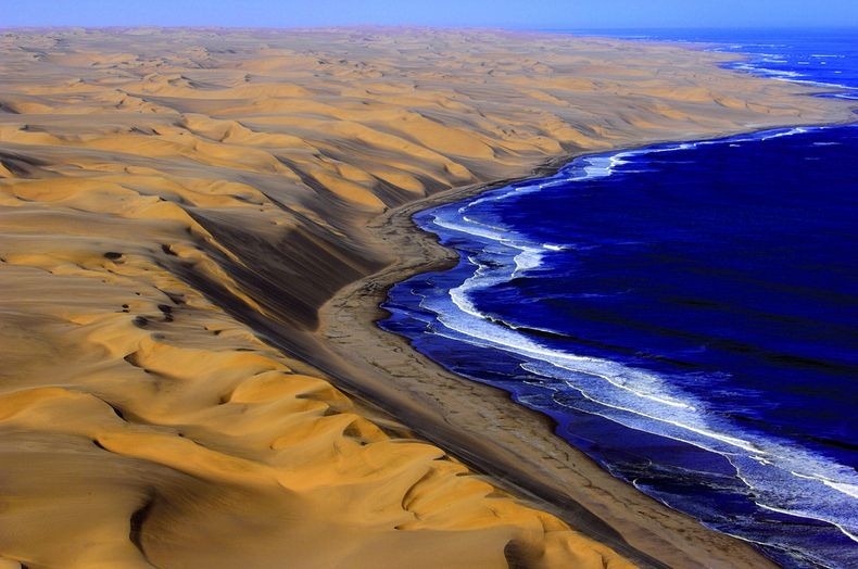
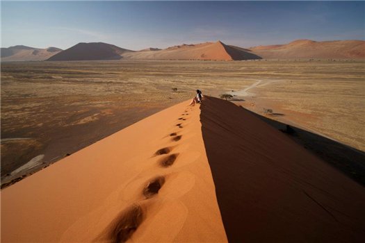
Namibia’s terrain consists of four major geographical segments: the Namib Desert in the west, where you will find almost no vegetation; a mountain wall, called the Escarpment, the height of which is up to 2000 meters; the Central Plateau, where most Namibian cities and town are situated; and the Kalahari Basin with dune ridges and sandy plains. The climate is arid, with about 300 sunny days a year.
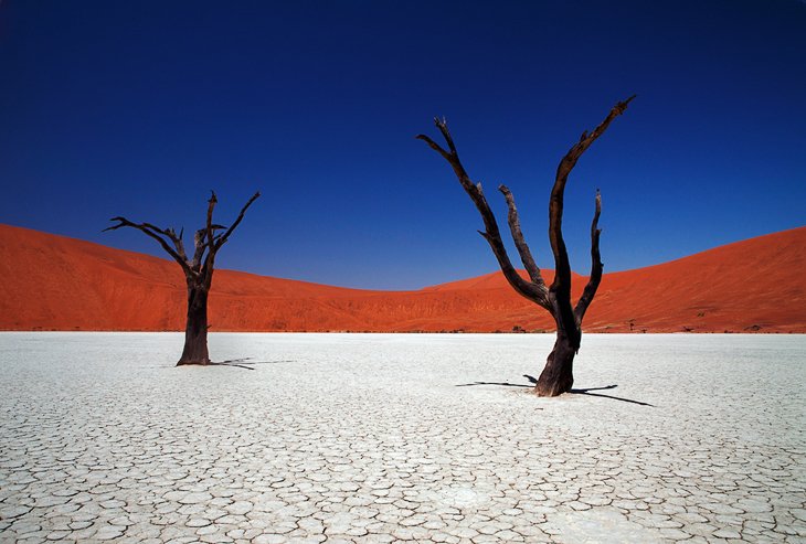
Namibia is a popular holiday destination for many tourists. Its stunning sceneries, picturesque sand dunes, wild animals in their habitat, volcanic craters and waterfalls attract lots of nature enthusiasts.
In Etosha National Park you can see the tallest elephants of Africa, rare black rhinos, lions, giraffes and lots of other interesting animals.
The Namib Naukluft Park boasts amazing sand dunes, among which you can see the Welwitschia, a unique plant whose lifespan is up to 1500 years.
Those who adore seals should visit Cape Cross, one of the world’s largest colonies of Cape Fur Seals. During the breeding season it is home to about 150 thousand seals.
Those who like outdoor activities can go hiking in the Fish River Canyon, the largest in Africa and very picturesque; or go on safari in the Waterberg Plateau Park, where you can meet rhinos, buffalos, sables and cheetahs.
If you want to learn more about the traditional life of Namibia, Nyae Nyae Conservancy is one of the best places for it. Here the Bushmen people live as they are used to, preserving their cultural identity. In Kaokoland you can enjoy stunning mountain landscapes and get acquainted with the Himba – an ancient semi-nomadic tribe. On Brandberg Mountain you can see fantastic rock engravings, made by ancient people thousands of years ago.
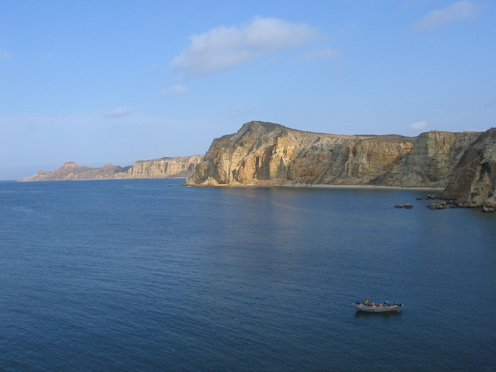
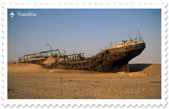
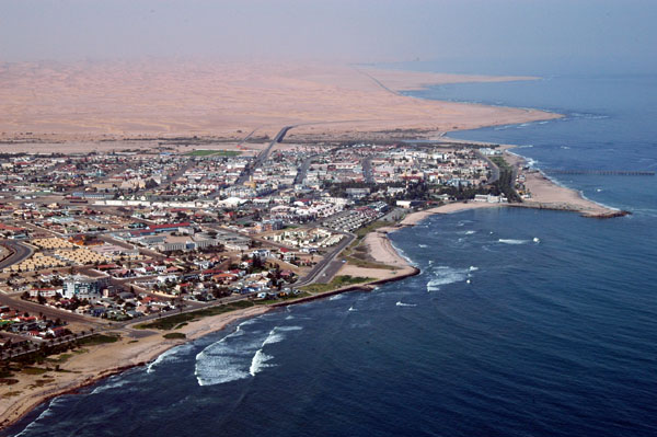
The Skeleton Coast offers macabre and captivating sight of lots of shipwrecks lying on the coast covered with seaweeds.
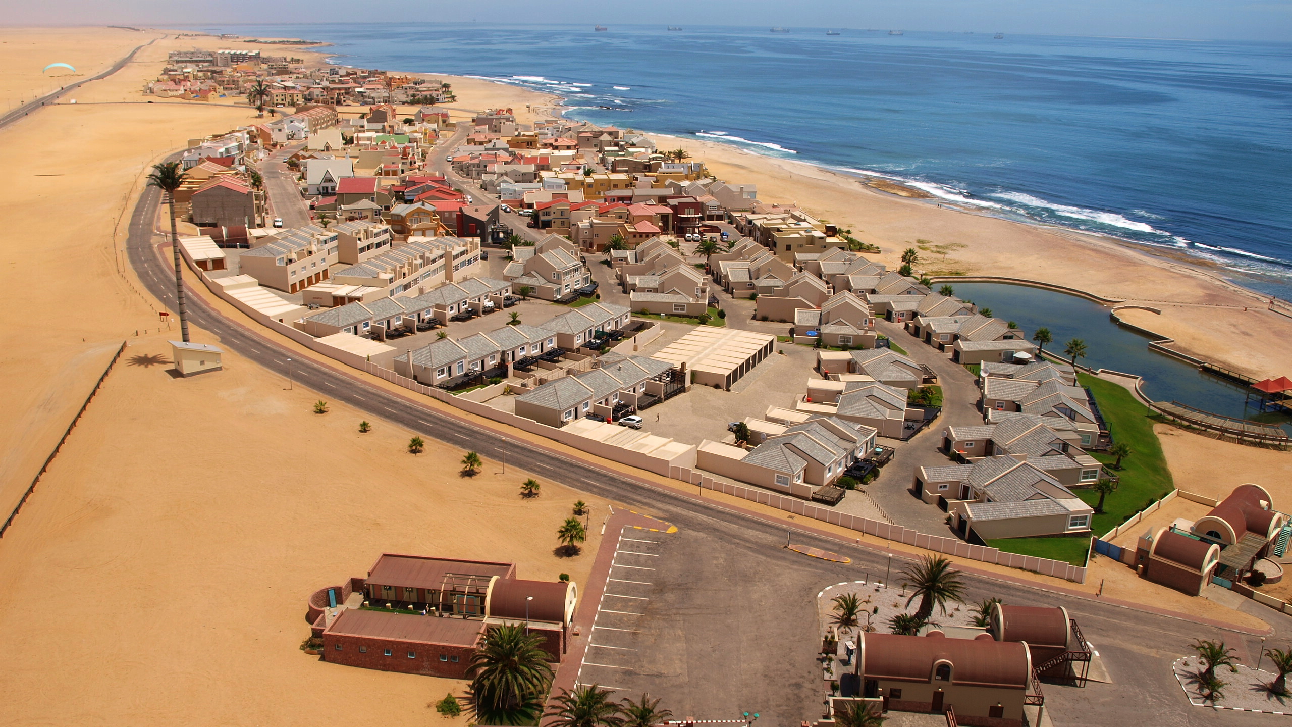
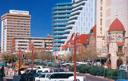
In Windhoek you can enjoy charming colonial architecture, take a tour of its famous lager brewery and visit the National Museum.
Airports
Hosea Kutako International Airport (WDH), the main international airport located 45 kilometers from Windhoek.
Diving in Namibia
Despite rather long coastline (about 1.5 thousand kilometers) Namibia is not a very popular diving destination. Difficult access to the desert coasts, strong currents, rough sea and bad visibility make diving in the ocean almost impossible.
However diving is possible in two freshwater lakes -- Lake Guinas and Lake Otjikoto.
Lake Otjikoto, situated about 20km from Tsumeb, is famous for the World War I artifacts, hidden in the lake in 1915 by German armed forces. There is a legend that they dumped a lot of gold there. There are two diveable areas:
The Reef, whose depth is 25m - 35m, where you can see toilets and Kudu horns;
And the deeper part with cannons, munitions and a small boat located at a depth of 45m - 55m.
The nearby Lake Guinas is suitable only for technical divers with 30-meter cliffs. On the bottom of the lake you will find caves with unknown depths. The visibility is about 30 meters.